HOW TO FILL ZENITH GAP IN DRONE PANORAMAS
How to patch a gap in zenith with PANOVOLO software
When capturing 360-degree panoramas with drones, many models leave a noticeable hole in the sky at the zenith. This problem occurs because most drone gimbals cannot tilt straight up to +90° pitch, leaving part of the sky not photographed. As a result, when the images are stitched together to create a spherical panorama, the missing data appears as a black hole in the sky.
The size and shape of this zenith hole depend on the drone model. For most drones, the hole is roughly circular and centered at the zenith. However, for models like the DJI Mini 3 and Mini 4 series, the hole can appear rectangular.
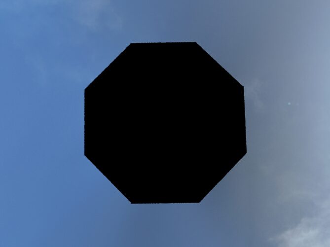
A black hole in the zenith detracts from the quality of 360-degree panoramas, especially when viewed interactively on social media or mapping platforms. Here are several ways to address this issue.
Using the Fill Sky Feature in PANOVOLO
The easiest and fastest solution is to use the “Fill Sky” option in PANOVOLO. Simply turn Edit/Fill sky option ON and create your 360° panorama as usual.
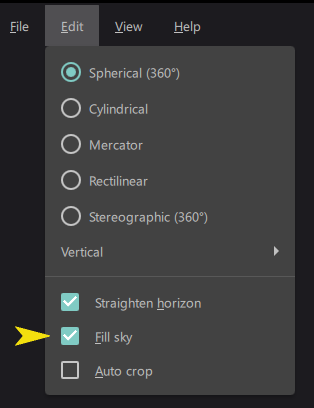
The software will automatically fill the zenith hole with interpolated data, blending it with the surrounding sky. While the algorithm typically produces convincing results, some artifacts may appear, especially in scenarios where:
- There is a sharp change in exposure in the images near zenith.
- The zenith hole is irregularly shaped.
Despite these limitations, the “Fill Sky” feature is a reliable choice for creating fully spherical panoramas without any visible gaps.

Using Context-Aware or Generative Fill
If you prefer to manually edit the zenith hole, photo editing software like Photoshop offers a “Context-Aware Fill” feature. Here’s how to use it:
- Select the top black area in the panorama using a tool like the Magic Wand.
- Expand the selection slightly.
- Apply the context-aware fill to selection.
Keep in mind that context-aware fill does not account for the equirectangular projection of spherical panoramas, which causes horizontal stretching near the poles. This may result in visible distortions when the patched panorama is viewed interactively.
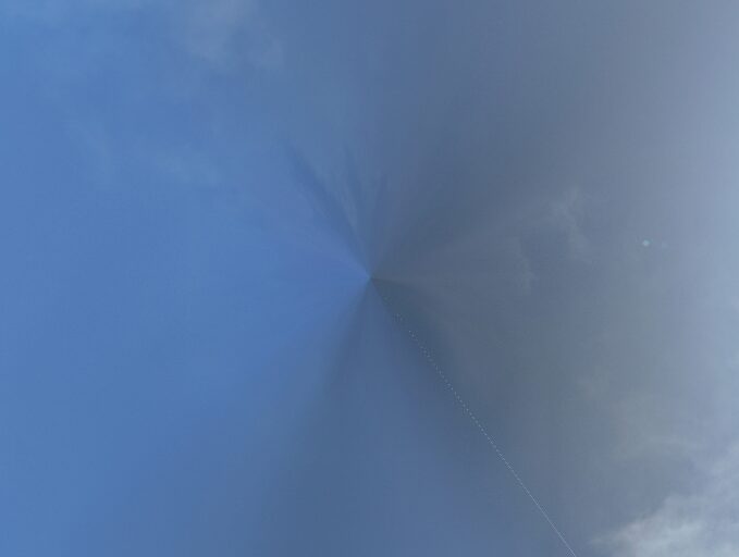
The result of patching the hole with PS context-aware fill. Note that this method can introduce some artifacts near the pole.
Similarly, AI-based generative fill tools can be used to fill the zenith hole, sometimes requiring a text prompt. However, these tools also lack an understanding of equirectangular panorama geometry, potentially leading to quality issues.
Shooting a Dedicated Image for the Zenith
For the best quality, capture an additional image specifically for the zenith region of the sky.
After the flight, rotate the drone so its camera points straight up (ensure the motors are off) and take a series of photos. Alternatively, use a smartphone or another camera to photograph the sky. Add these images to the directory containing your panorama images and stitch the panorama.
Be mindful of potential challenges, such as:
- Differences in exposure or white balance between the zenith image and the main panorama images.
- Difficulty in stitching if there are no control points to align the zenith image.
- Ensuring the zenith image format matches the rest of the panorama (e.g., RAW/DNG or JPEG).
Special Case: DJI Mini 3 and Mini 4 Drones
For DJI Mini 3 and Mini 4 drones, the zenith hole is relatively small and rectangular. PANOVOLO allows you to manually adjust images to close this gap:
- Go to the “Review” tab (“View/Review“) in PANOVOLO.
- Identify the two topmost images – images closest to the zenith.
- Adjust the “pitch” parameter for these two mages by about +3-5 degrees (experiment to find the optimal value).
- Render the panorama again.
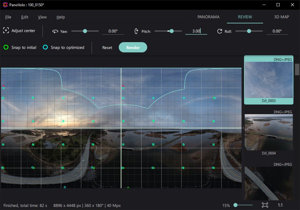
This method often patches the hole seamlessly. Minor tweaks to the pitch settings may be required to achieve the best results.
Conclusion
Most drones leave a zenith hole in 360-degree panoramas, but there are several effective ways to address this issue. The “Fill Sky” option in PANOVOLO is the fastest and most convenient solution for most users. For higher-quality results, consider capturing a dedicated image for the zenith. With these tools, you can ensure your panoramas are polished and ready for interactive viewing.
